
Clash Detection
3D models built from your design, compared against existing site conditions to verify clashes before they occur.
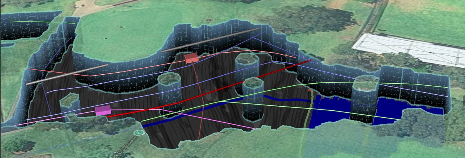
Our specialist modelling teams can develop 3D models from your design plans and documents, allowing you to compare this with existing site conditions to verify potential clashes before they occur on site.
When it is used
During design development, before construction starts, and ahead of any works where a conflict found in the ground would stop the job. Finding a clash on a drawing is a design change. Finding the same clash with an excavator is an incident, an outage and a delay.
What it depends on
The value of a clash check is set by the quality of the service information beneath it. Conflicts identified against Quality Level A information are proven. Conflicts identified against located but unexposed services carry the tolerance of the locating method, which is why critical points are usually potholed first.
How it works with the rest
Clash detection sits at the end of the investigation and depends on everything before it. It is the step that turns a service plan from a record into a decision the design team can act on.
Before excavation starts, know what’s below.
Underground service locating, GPR scanning, physical verification, survey pickup and detailed reporting across Western Australia.