
Multi-Array 3D Ground Penetrating Radar
High-density subsurface mapping for complex sites and service corridors.
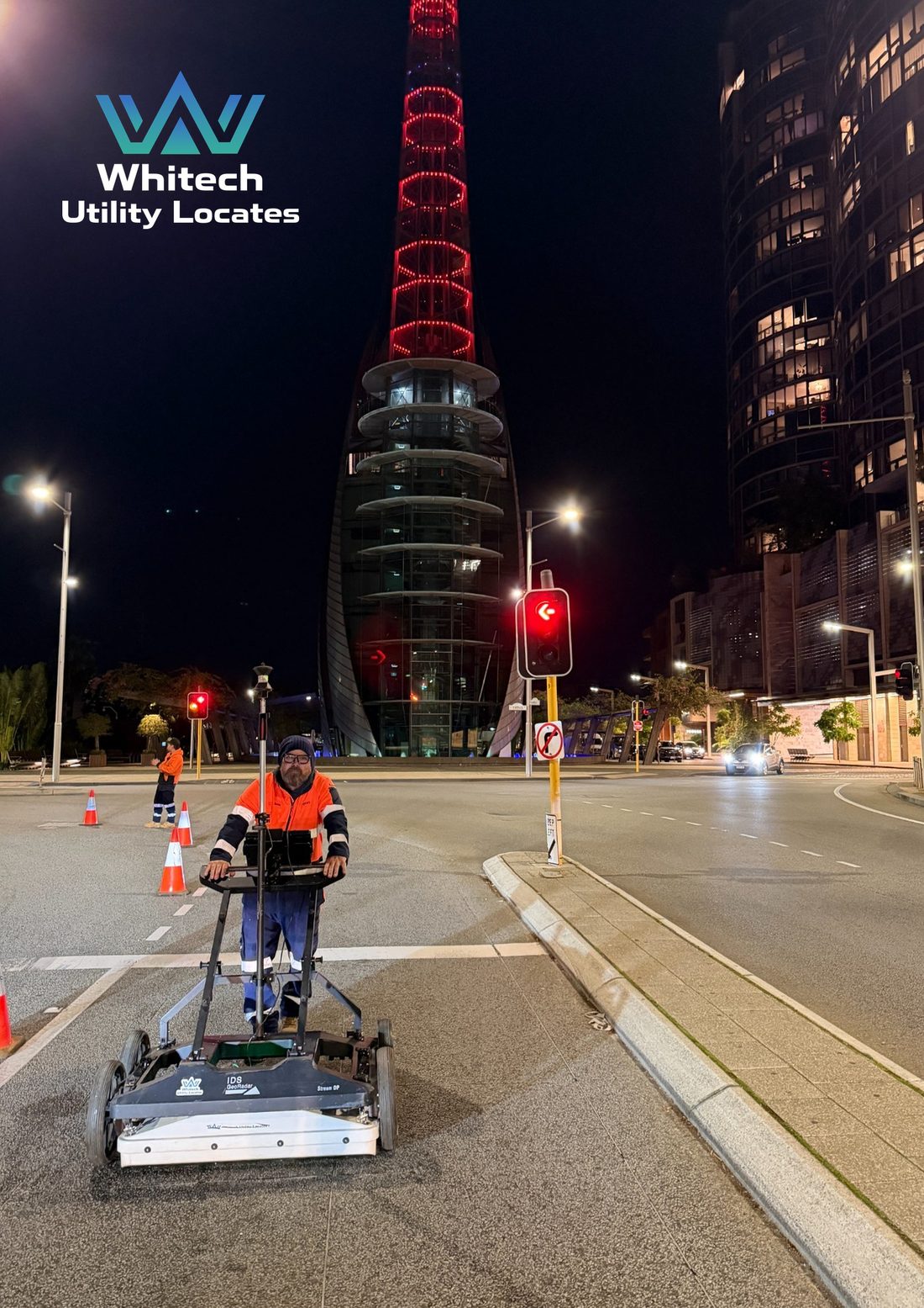
Multi-array GPR uses multiple antenna channels arranged across the width of the system. Closely spaced measurements are collected in a single pass and processed into a detailed 3D dataset, allowing the survey area to be reviewed from multiple directions and depths.
Key benefits
- Wide, high-density coverage with fewer passes
- True multi-channel 3D datasets rather than isolated profiles
- Improved visibility of complex and overlapping service corridors
- Efficient survey of roads, intersections and large open areas
- Horizontal depth slices support detailed interpretation
- Georeferenced results integrate with survey and project drawings
Typical applications
- Utility mapping in roads, intersections, verges and footpaths
- Large-area and linear corridor investigations
- Congested areas where multiple services overlap
- Buried pits, structures, voids and other subsurface anomalies
- Design support, construction planning and clash detection
- Pavement, bridge deck, archaeological and forensic investigations
Processing and interpretation
Processing tools assist with visualisation, quality control and feature recognition. Results are reviewed and interpreted by experienced personnel using available plans, site evidence and complementary locating methods.
Integrated investigation
Multi-array GPR is used alongside electromagnetic locating, BYDA information, surface evidence and survey control. This combined approach provides a more complete understanding of subsurface conditions and supports defensible project deliverables.
Broad corridor coverage
Georeferenced depth-slice data can demonstrate continuous coverage across complex sites, which is what allows a claim of coverage to be shown rather than asserted.
Deliverables
Interpreted mapping, CAD/DXF data, PDF plans, 3D outputs and reporting.
Multi-array vs traditional GPR
| Aspect | Multi-array GPR | Traditional GPR |
|---|---|---|
| Coverage | Wide swath in each pass | Single profile per pass |
| Dataset | Dense multi-channel 3D data | Individual 2D profiles |
| Field efficiency | Suited to large and congested areas | Suited to targeted investigations |
| Visualisation | Depth slices and 3D review | Profile-based interpretation |
| Positioning | GNSS, total station and encoder | GNSS or local reference |
| Best suited to | Roads, corridors and area mapping | Tight access and specific targets |
Multi-array and traditional single-channel GPR both remain valuable tools. The most appropriate system depends on the target, access, required coverage and deliverables.
How it works with the rest
Multi-array and traditional single-channel GPR both remain valuable tools. The most appropriate system depends on the target, access, required coverage and deliverables.
Before excavation starts, know what’s below.
Underground service locating, GPR scanning, physical verification, survey pickup and detailed reporting across Western Australia.